Rottnest Island Map: Bays, Bike Routes And Tour Stops
Rottnest Island packs 63 beaches and 20 bays into a space just 11 km long and 4.5 km wide. This written map lays out the bays by role, the three bike loops, the bus stops and the lookouts so you can plan a day around what you actually want to see.
Short answer
Rottnest Island is 11 km long, 4.5 km wide and 19 km2, with a highest point of 45 m. Everything begins at Thomson Bay and the Main Jetty. A full island loop by bike covers 22 km and takes 3 to 5 hours; the Island Explorer bus serves 19 stops from about 8:45 am to 3 pm.
A paper map of Rottnest Island looks deceptively simple: a foot-shaped blob, one settlement, a road that traces the coast. The reality is denser. This is an island of 63 beaches, 20 bays and 12 salt lakes squeezed into 19 km2, with no visitor cars, one hop-on hop-off bus line, 22 km of cycle paths and a walking network, the Wadjemup Bidi, that stretches 45 km across five trails, according to the island's own location and geography page.
This guide works as a written map. It groups the bays by what each is actually good for, maps the three bike loops against the time they take, lists what the Island Explorer bus stops mean in practice, and locates the seal platform, the snorkel trail and the island's high point. Along the way it points to the ferry and bike packages and the guided bus tour that cover most of this ground for you.
How Big Is Rottnest Island Really?
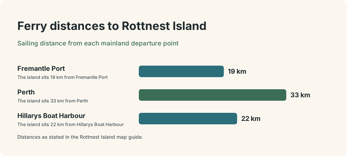
Rottnest Island measures 11 km long by 4.5 km wide, covering 19 km2, and its highest point rises just 45 m above sea level. Those small numbers matter for planning: the island never feels vast, but the coastal wind, the sand and the lack of shade can make a modest distance feel much longer than the map suggests. The island sits 19 km from Fremantle Port, 33 km from Perth and 22 km from Hillarys Boat Harbour, which is why ferry crossing times vary so much by departure point: about 25 minutes from Fremantle, 45 from Hillarys and up to 90 from Perth's Barrack Street Jetty.
The compact size is the island's great gift to day trippers. A cyclist of average fitness can ride the full 22 km perimeter in three to five hours with stops, and the whole island is only 11 km long. The shape helps too: because the road hugs the coast almost the whole way around, a loop ride passes a beach or bay every few hundred metres, and the salt lakes sit inland in the middle of the foot-shaped landmass.
Two practical notes follow from the size. First, the island is car-free for visitors: only approved public transport and service vehicles are allowed, so your map reading is done on foot, by bike or from the bus. Second, the island authority recommends carrying at least 2 L of water per person, or 3 L in hot weather, with refill points at Thomson Bay, Army Jetty, Kingstown Barracks, The Basin, Vlamingh Lookout and Geordie Bay. Refill stops, not distances, are what shape most people's routes. Before you plan your refill stops, it helps to know whether the tap water itself is drinkable, and the verified guide to Rottnest's tap water safety covers exactly that question.
Thomson Bay: The Settlement And The Main Jetty
Every ferry arrives at the Main Jetty in Thomson Bay, on the island's eastern side, and the settlement behind it holds nearly everything you need on arrival: the Visitor Centre, bike hire, the General Store, the bakery, the Salt Store and the bus stop for the Island Explorer. Treat Thomson Bay as the anchor point on your map. The free daily walks run by the Rottnest Voluntary Guides depart from the Salt Store, next to the Information Booth, with Meet the Quokkas heading out at about 9:15 am and 2 pm, subject to weather and volunteer availability. The Wadjemup Museum, in the Old Mill and Hay Store, is open daily from about 10 am to 3:30 pm, entry by contribution.
From the jetty, the geography is straightforward. Thomson Bay curls north toward Geordie Bay, with the settlement strung along its southern shore. Pinky Beach and The Basin sit a short walk to the southwest of the main settlement, roughly ten minutes on foot. Army Jetty and Kingstown lie to the north and west. Almost every mapped activity on the island is described by its direction and distance from this one point.
That is also why the ferry and bike packages work so well as a mapped-out day: they pin the crossing, the bike and the island admission to a single booking, and drop you at the exact point from which the whole island is measured. The same logic applies to the guided bus tour, which collects passengers near the settlement and covers the perimeter with commentary, useful on a first visit when the map still reads as an abstract shape. If you are weighing the two approaches, the homepage comparison on Rottnest Tours breaks down the ferry-and-bike and bus-and-ferry options side by side.
The Bays By Role: Swimming, Snorkelling And Seals
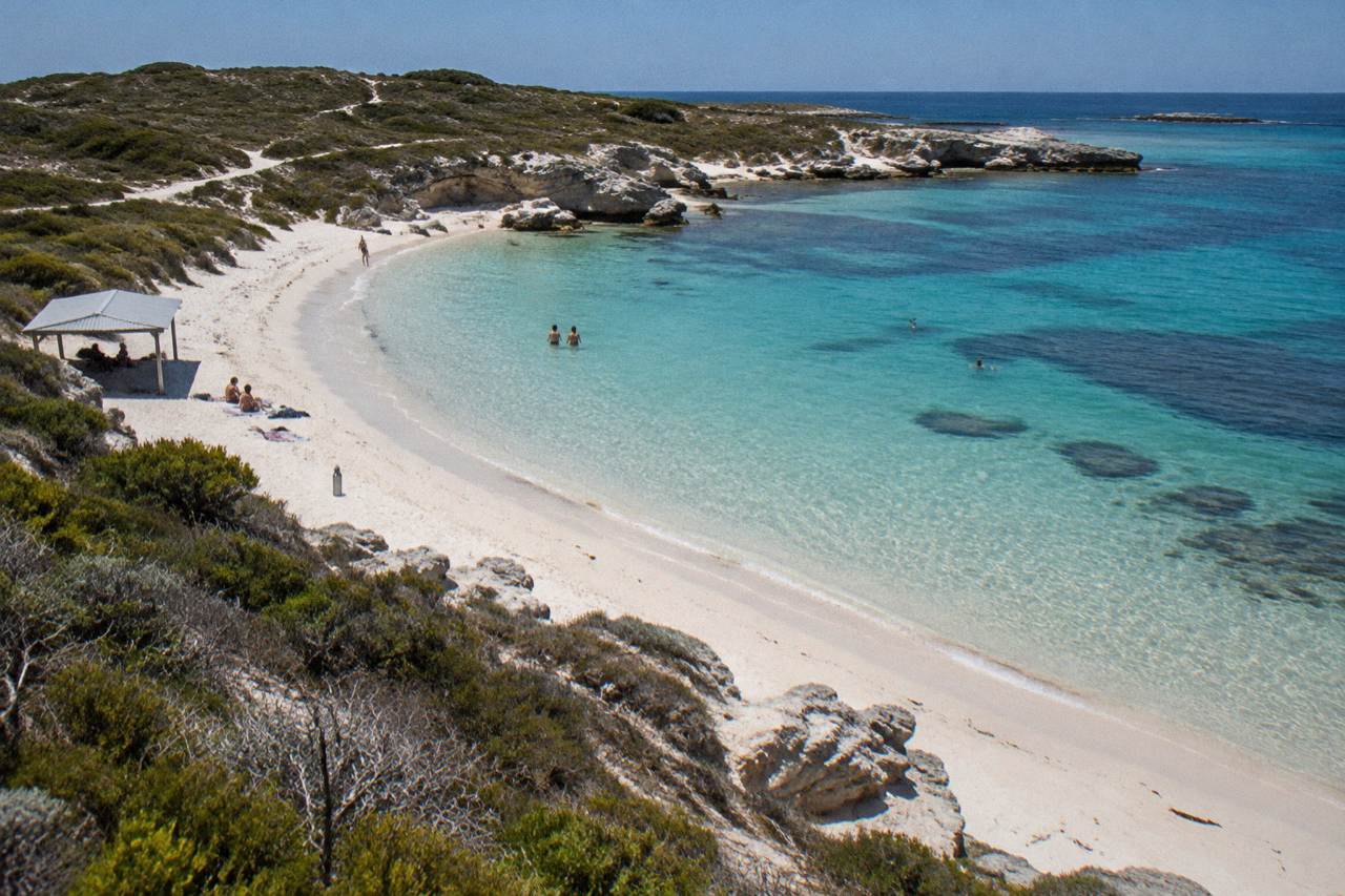
Map Rottnest's bays by what you want to do, not by their names: Pinky Beach and The Basin for sheltered swimming near the settlement, Parker Point for the snorkel trail with its 12 seabed plaques, Geordie Bay for a quieter family beach, and Cathedral Rocks on the western tip for the long-nosed fur seal viewing platform. The island's official count of 63 beaches and 20 bays is real, but most visitors touch only four or five, and choosing them by role beats trying to see them all.
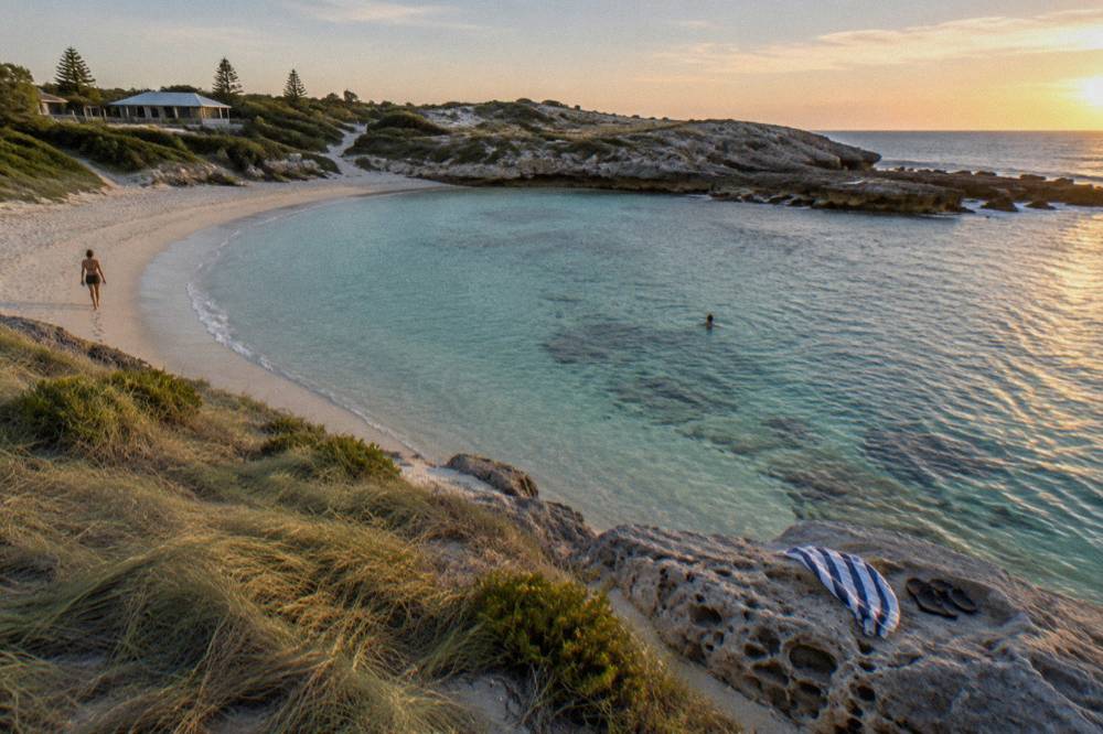
The swimming beaches cluster near the settlement. The Basin is the classic sheltered swim, protected by a rock ring; Pinky Beach sits beside it, about a ten minute walk from the main settlement. Neither is patrolled: the Rottnest Island Authority states plainly that beaches are not patrolled by lifeguards, so swim with a friend, check conditions and avoid the zones between the main ferry jetty and the Fuel Jetty. Blue bottle jellyfish can be present at any time of year, and they should not be touched.
| Bay or beach | Direction from Thomson Bay | Best for | Map note |
|---|---|---|---|
| Thomson Bay | On arrival | Settlement, museum, free walks, jetties | Anchor point |
| Pinky Beach | Southwest, about 10 min walk | Sheltered swimming, sunsets | Near Discovery eco-tents |
| The Basin | Southwest of Pinky | Sheltered rock-ringed swim | Refill point |
| Geordie Bay | North of settlement | Quieter family beach | Second General Store, shuttle stop |
| Parker Point | South coast | Snorkel trail, sanctuary zone | Island Explorer Stop 5 |
| Little Salmon Bay | South coast near Parker Point | Second snorkel trail, 10 buoys | Sanctuary zone |
| Cathedral Rocks | Western tip near Cape Vlamingh | Fur seal viewing platform | Bus stop and lookout nearby |
Snorkellers should pencil two south-coast sites onto the map. The Parker Point Snorkel Trail lies in a marine sanctuary zone, holds 12 interpretive plaques on the seabed and sits a 17-minute bike ride from Thomson Bay, also served by Island Explorer Stop 5. Little Salmon Bay's trail is marked by ten buoys above more seabed plaques. Both sit inside sanctuary zones where fishing and collecting are prohibited, part of a network of five zones around the island, as listed on the official sanctuary zones page.
At the far western tip, Cathedral Rocks carries a resident colony of long-nosed fur seals and a purpose-built viewing platform. Swimming with the seals is not permitted, and the platform is the right way to watch them. Ospreys nest on rocky stacks around the coast, and humpback and southern right whales pass offshore between August and December, sometimes visible from the ferry itself, though no listing on this site guarantees a sighting.
If your map priority is water rather than land, the guided options concentrate in the same south-coast zone. A half-day catamaran snorkel and sail trip departs Thomson Bay with gear, kayaks and paddleboards included, and a guided snorkel boat experience covers similar water with a guide in the water beside you. Both are booked on the island, which makes them easy to slot around a morning bike loop or an afternoon bus ride.
The Three Bike Loops, With Times
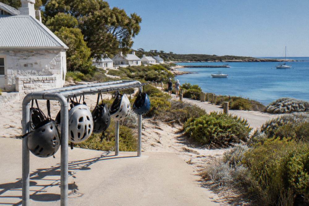
Rottnest has 22 km of cycle paths and three natural loops: the Rotto Mini Loop at about 30 minutes, the 10 km Beaches, Lighthouses and Lakes trail at 1.5 to 3 hours, and the full 22 km island loop at 3 to 5 hours. All three start and end at Thomson Bay, and helmets are required by law. The loop you choose should follow your ferry timing more than your fitness, because the return sailing is the one deadline a bike map cannot bend.
| Loop | Distance | Typical time | What the map shows |
|---|---|---|---|
| Rotto Mini Loop | Short circuit near settlement | About 30 min | Thomson Bay edges, an easy warm-up |
| Beaches, Lighthouses and Lakes | 10 km | 1.5 to 3 hours | South coast bays, salt lakes, lookout country |
| Full island loop | 22 km | 3 to 5 hours | Every bay, Cathedral Rocks, West End, Geordie Bay |
The full loop deserves its reputation. Leaving the settlement northbound, the road runs past Geordie Bay and Kingstown before swinging west to Cathedral Rocks and Cape Vlamingh, then tracks the southern shore through Little Salmon Bay and Parker Point before easing back into Thomson Bay. Ride it with the wind in mind, carry water, and treat the sanctuary zones on the south coast as your natural swim stops. The island authority's cycling page is the source for the loop times and the helmet rule.
Not everyone wants to hire a bike separately and carry it on a ferry. The ferry and bike day from Hillarys is built exactly around the loop logic above: same-day return ferry transfers from Hillarys Boat Harbour, all-day bike, helmet and lock rental, the island admission fee and optional courtesy hotel pickup from selected Perth and Scarborough hotels, from A$124 per person, rated 4.7 from 2,937 reviews. It is the simplest way to put a bike under the map you just drew. Our guide to Rottnest bike hire options covers the alternative of hiring on the island instead, at Pedal & Flipper's listed rates.
The Island Explorer Bus: 19 Stops Around The Map
The Quokka Coaches Island Explorer is a hop-on hop-off bus circling the island with 19 stops, running daily from about 8:45 am to 3 pm at roughly 15-minute intervals, with tickets sold at the kiosk at the Main Bus Stop from 8:35 am. It is the only motorised way for visitors to cover the map. A Seasonal Transport Pass gives 12 trips for A$180 adult or A$120 child, bought in person; a single-trip fare is not published in the island's dated sources, so budget from the pass if you plan multiple hops.
The stops do the mapping work for you. Stop 5 is Parker Point and the snorkel trail. A stop serves Cathedral Rocks and the seal platform. Others serve The Basin, Little Salmon Bay, the West End lookouts and Geordie Bay. On a short visit, or on a day when the wind makes riding unpleasant, hopping between three or four well-chosen stops covers more of the island's geography than a hurried full loop.
| Stop or zone on the route | What it connects to on the map |
|---|---|
| Main Bus Stop, Thomson Bay | Settlement, ferry jetty, bike hire, museum |
| The Basin / Pinky Beach area | Sheltered swimming close to settlement |
| Geordie Bay | Family beach, second General Store |
| Parker Point (Stop 5) | Snorkel trail, 12 plaques, sanctuary zone |
| Little Salmon Bay | Second snorkel trail, ten buoys |
| Cathedral Rocks / Cape Vlamingh | Fur seal viewing platform, West End lookouts |
The island authority warns that the Island Explorer and the guided discovery tours often book out during peak periods, particularly school holidays and the summer weeks from 17 December 2026 to 31 January 2027. If your day depends on the bus, book the ferry in advance and treat the bus kiosk as your first stop off the jetty.
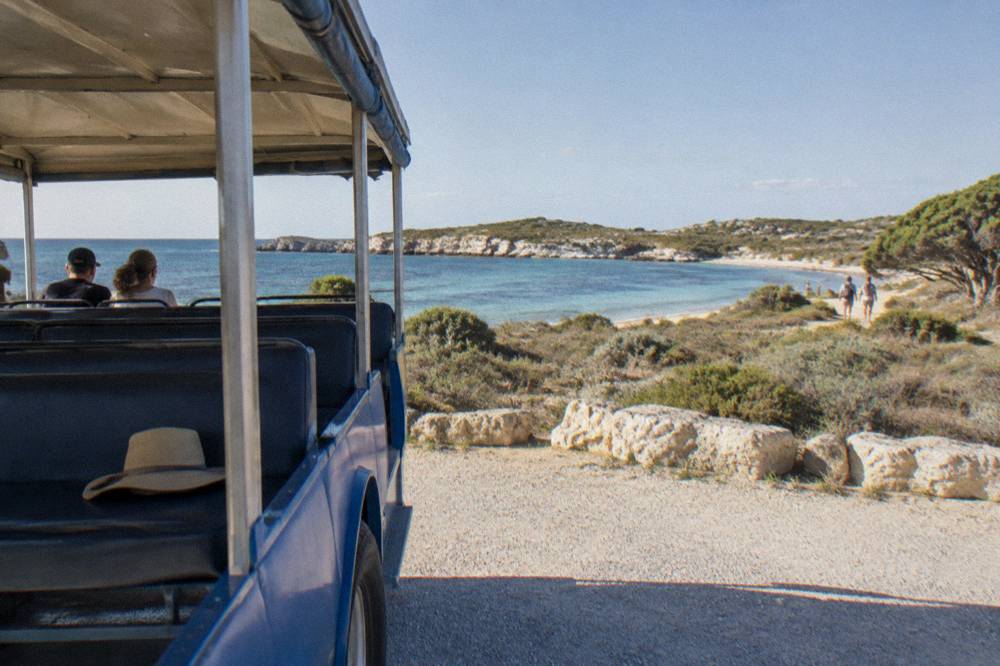
For visitors who want the perimeter covered with commentary rather than handlebars, the ferry and bus tour pairs return ferry tickets with a 1-hour 45-minute guided bus tour and island admission, from A$149 per person, rated 4.6 from 1,512 reviews, with a Swan River scenic cruise included when departing from Perth. It maps the island for you, which is exactly what some first visits need.
On Foot: Lookouts, The High Point And The Bidi
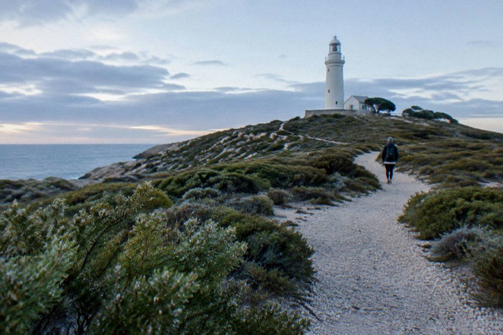
The island's highest point rises just 45 m, at the country around the lighthouse inland of the settlement, and a network of 45 km of walking trails, the Wadjemup Bidi, threads five trails through it. Map readers should note the key lookouts: Vlamingh Lookout near the West End, with a water refill point, and the views down over the salt lakes from the interior paths. Walking turns the two-dimensional map into terrain: limestone, sand and, in warmer months, very little shade.
The Bidi, whose name is the Noongar word for trail, includes long sections such as the Ngank Yira Bidi of about 10 km one way, and self-guided walkers can join or leave it at many points near bus stops and bays. For something shorter, the free Voluntary Guides walks from the Salt Store cover wildlife, heritage and coast in about an hour each, no booking required. Go Cultural Aboriginal walking tours of one to two hours add the Wadjemup story from a Whadjuk Noongar perspective, a layer of the map most visitors never see. Our Wadjemup Aboriginal heritage guide explains the history that shaped these places.
Wildlife belongs on the walking map too. Quokkas, the world's largest population of them, an IUCN assessment putting the island at 8,000 to 12,000 animals, are mainly nocturnal and most active early morning and late afternoon, with cooler months raising daytime activity. The rules are strict and mapped in signs everywhere: do not touch or feed wildlife, with on-the-spot fines and penalties up to A$10,000 under the Biodiversity Conservation Act 2016, as set out on the official wildlife protection page. Dugites are present on the trails, so give any snake a wide berth and seek medical help if bitten.
If two wheels and two feet both sound like too much map for one day, a middle path exists. The adventure tour with ferry and high-speed wildlife cruise combines the crossing from Perth or Fremantle with a 90-minute coastal run that shows the map from the water, from A$164 per person, rated 4.5 from 244 reviews. Guest reviews of the crossing sometimes mention whales and dolphins, but sightings are seasonal and never guaranteed.
Planning A Day Around The Map
A workable mapped day looks like this: arrive at the Main Jetty, decide between bike and bus within your first twenty minutes, ride or hop the south coast to Parker Point and Little Salmon Bay for snorkelling, push west to Cathedral Rocks for the seals, then return through Geordie Bay before your ferry. Reverse the direction if the wind favors it. The single most common mapping mistake is planning east-coast beaches in the middle of the day and the West End in the afternoon, leaving the long leg against the clock.
Time budgeting helps. The full bike loop's 3 to 5 hours plus a ferry crossing plus lunch is already a full day, which is why our Rottnest day trip guide recommends choosing either the south coast or the West End as your deep stop, not both. Families with young children usually map a smaller day: Pinky Beach, The Basin, the settlement and one bus hop. Strong swimmers and snorkellers map the opposite, spending the whole day between Parker Point and Little Salmon Bay.
Drones are worth a mapping note: recreational drones are not permitted on Rottnest Island, so the aerial shot of your loop is off the table. Fires are prohibited across the Class A Reserve, and the two General Stores at Thomson Bay and Geordie Bay, open seven days roughly 8 am to 6 pm, are your food and water resupply on the map, with holiday variations.
For a guided spin over the same geography at a gentler pace, the fortress segway tour runs about 1.5 hours around the island's military heritage with training, guide and radio headsets included, from A$139 per person, rated 4.8 from 117 reviews. It maps neatly onto a day that already includes a bus tour or a short ride, because it starts and ends near the settlement.
Which Parts Of The Map Can You Actually Skip?
Honestly mapped: most visitors can skip the salt lake interior beyond one lookout, the Kingstown industrial fringe, and any second or third swimming beach that duplicates the first. The unskippable core is Thomson Bay, one south-coast snorkel stop, the West End or Cathedral Rocks, and The Basin or Pinky Beach. Sixty-three beaches is a fact, not a checklist, and the happiest days on the island are mapped around three anchors rather than a forced march.
Decide your anchors by season. In the warmer months the water is the point, and the map tilts south: Parker Point, Little Salmon Bay, The Basin. In the cooler months, when quokkas are more active by day and the whale season runs from August to December, the map tilts west and toward the walking trails, the Vlamingh Lookout and the coastal paths where humpbacks can pass close enough to see from the cliffs. Sea temperatures average about 22C in summer and about 18C in winter, which is why snorkelling maps differently across the year.
Whichever anchors you choose, transport decides the day. The bike-and-ferry packages from Fremantle run from A$127 per person, the Hillarys equivalent from A$124, and the bus-and-ferry combination from A$149, all with island admission included. Book ahead for peak periods, check the operator's live listing for seasonal timetables, and let the map flex around the one fixed point: your return sailing.
Common Questions About The Rottnest Island Map
How Big Is Rottnest Island On A Map?
Rottnest Island is 11 km long and 4.5 km wide, covering 19 km2, with a highest point of 45 m. The full coastal loop by bike is 22 km and takes most riders 3 to 5 hours with stops.
Where Does The Ferry Arrive On The Island?
All ferries arrive at the Main Jetty in Thomson Bay, on the eastern side of the island. The settlement behind the jetty holds the Visitor Centre, bike hire, the General Store, the museum and the Main Bus Stop for the Island Explorer.
How Many Bus Stops Does The Island Explorer Have?
The Quokka Coaches Island Explorer serves 19 stops, running daily from about 8:45 am to 3 pm at roughly 15-minute intervals. Stop 5 serves the Parker Point snorkel trail, and other stops cover The Basin, Geordie Bay, Little Salmon Bay and Cathedral Rocks.
Which Bay Is Best For Snorkelling?
Parker Point is the mapped snorkelling anchor, with a trail of 12 interpretive plaques on the seabed inside a marine sanctuary zone, a 17-minute bike ride from Thomson Bay. Little Salmon Bay, marked by ten buoys, is the second snorkel trail nearby.
Where Can You See Seals On The Map?
Cathedral Rocks, near Cape Vlamingh on the western tip, hosts a resident colony of long-nosed fur seals with a purpose-built viewing platform. Swimming with the seals is not permitted.
Can You Walk The Whole Island?
The walking network, the Wadjemup Bidi, covers 45 km across five trails, with individual sections such as the Ngank Yira Bidi at about 10 km one way. Most day visitors walk shorter legs and use the bus or a bike to link the bays.